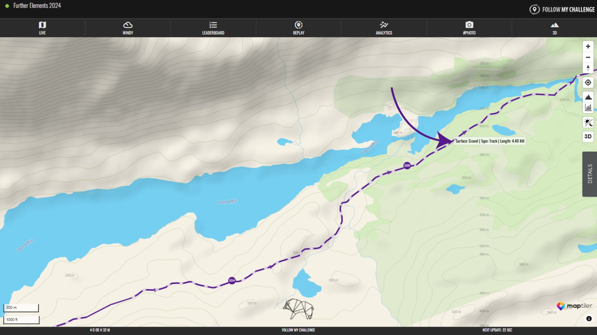
Some preloaded routes will display surface data, based on what our algorithm has detected. This algorithm uses Open Street Map data – which includes reported surface data for some roads and tracks – to estimate which parts of the route are unpaved. These unpaved sections are displayed with dashed white lines.
Because the Open Street Map data does not contain comprehensive surface data and our algorithm has to make educated guesses based on several factors, the accuracy will never be 100%. In parts of the world where the data is better or where public roads are almost always paved, the algorithm is likely to be far more accurate.
To see the identified surface (if it is know), as well as the track type and length of the section, click or tap on an unpaved part of the route. This will bring up a small pop-up displaying what is known about this section.